
Zoe Schulz · 25 October 2026
Surge in Rodent Engineering Activity Reshapes Remote Streambeds
Monitoring programs across several upland watersheds have recorded a marked increase in rodent engineering behaviors that directly modify stream channels and sediment distribution, and these changes concentrate in the most isolated headwater zones where human access remains limited. Field teams from multiple agencies noted expanded dam construction and burrow networks beginning in late summer and continuing through October 2026, periods when cooler temperatures and higher moisture levels typically support heightened activity among species such as beavers and muskrats.
Documented Patterns in Headwater Systems
Data collected by regional wildlife services show that construction intensity rises sharply once water temperatures drop below 15 degrees Celsius, prompting rodents to reinforce existing structures and initiate new ones in narrower channels. These efforts produce measurable shifts in flow velocity, pool depth, and gravel sorting, while the resulting impoundments trap fine sediments that would otherwise move farther downstream during seasonal runoff events. Researchers tracking GPS-tagged individuals have confirmed that many animals relocate to upper tributaries during this window, concentrating their labor where vegetation cover offers both food and building materials.
Surveys conducted in October 2026 across three separate mountain ranges revealed that newly formed dams averaged 1.8 meters in height and extended channel inundation by an average of 45 meters upstream from each structure. Sediment cores extracted from these sites contained layered deposits of sand and organic matter that differ noticeably from pre-construction profiles, indicating rapid accumulation within a single season. Such layering alters local invertebrate communities and creates conditions that favor certain aquatic plant species over others.
Methods Used to Track Activity Levels
Biologists employ a combination of aerial imagery, motion-activated cameras, and water-level loggers to quantify engineering output without repeated site visits that might disturb the animals. Time-lapse sequences captured this fall documented nightly additions of branches and mud to dam crests, with activity peaks occurring between dusk and midnight. Cross-referencing these visual records with discharge measurements downstream demonstrates how even modest dams can reduce peak flows by 20 to 30 percent during moderate rain events, a finding corroborated by similar instrumentation networks operated by Environment and Climate Change Canada in comparable terrain.
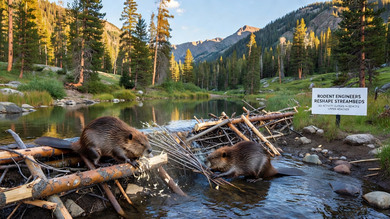
Remote sensing also reveals vegetation responses that follow dam installation within weeks. Willows and sedges establish along the newly wetted margins, their root systems further stabilizing banks against future high-flow erosion. These plant communities, in turn, provide additional forage and cover, supporting larger family groups that continue the cycle of modification into subsequent seasons. Observers note that once a colony occupies a reach for more than one year, the cumulative effect on channel sinuosity becomes visible even in standard topographic mapping updates.
Broader Watershed Implications
Hydrologic models developed by the US Geological Survey incorporate these localized changes and project that widespread rodent activity in headwaters can moderate downstream flood peaks and improve baseflow conditions during dry periods. The models rely on repeated LiDAR flights that capture elevation shifts caused by sediment trapping and bank slumping, producing datasets that feed into larger river-basin simulations. Although each individual dam exerts influence over a limited distance, the aggregate impact across dozens of structures within a single sub-basin registers in annual sediment budgets and nutrient transport calculations.
Long-term monitoring stations maintained by university research groups have logged multi-year trends showing that reaches with sustained rodent presence maintain higher habitat heterogeneity than those without such activity. Pool-riffle sequences become more pronounced, and temperature refugia form behind dams during summer heat spells. These physical alterations support fish populations that require varied depth and velocity profiles for different life stages, a relationship documented in peer-reviewed studies from institutions across North America.
Conclusion
Continued surveillance through the coming winter will clarify whether the October 2026 surge represents a temporary response to favorable moisture conditions or the beginning of a longer-term shift in rodent distribution within upper watersheds. Integration of field measurements with remote sensing and modeling efforts already provides resource managers with updated maps of altered stream segments, allowing more precise targeting of restoration or monitoring priorities. As datasets accumulate, the role of these small but persistent engineers in shaping channel morphology and sediment dynamics grows clearer, informing watershed planning across multiple jurisdictions.